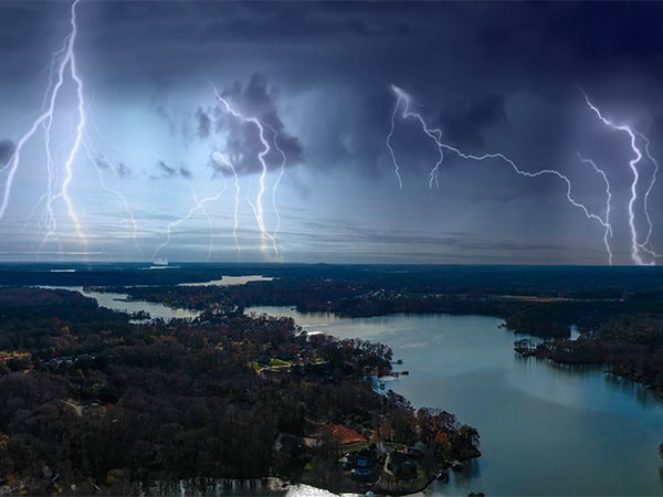
As we brace for yet another record-breaking storm season, the stakes have never been higher. Severe weather events are becoming increasingly frequent and unpredictable, a trend fueled by our rapidly warming planet. Over the past decade, the U.S. has experienced more than 391 weather and climate disasters since 1980, exceeding $2.755 trillion in damage, according to the National Oceanic and Atmospheric Administration (NOAA). So, just how reliable are the forecasts for these weather events? Let’s explore the science behind storm predictions and their importance in our climate-challenged world.

Will we really experience the predicted number of high-intensity storms?
It only takes one storm to cause a major disaster, and that’s reason enough to follow weather predictions and be prepared for what could happen in your area. The Earth is experiencing unprecedented warming, which is leading to rising sea levels, higher temperatures, and unpredictable seasonal weather patterns. These changes affect crops, cause severe property damage, and threaten infrastructure. We have moved past the point of wondering if weather and storm predictions are alarmist; we now must prepare.
Up to $106 billion of coastal property will likely be below sea levelby 2050. Rising sea levels amplify hurricanes' impacts by increasing the reach and severity of storm surges and causing more frequent nuisance flooding, thereby exacerbating the overall risk to coastal communities and infrastructure.
Approximately 30% of the U.S. population lives in relatively high-density coastal areas.
"The average temperature of the contiguous U.S. in April was 53.8°F, 2.7°F above average, ranking 12th warmest in the 130-year record. April temperatures were above average across much of the contiguous U.S., while near- to below-average temperatures were observed in parts of the West, northern Plains, Upper Midwest, Southeast, and in small pockets of the Northeast. Virginia and West Virginia each had their fifth-warmest April on record."
NOAA
Energy (ACE) index pointing to a hyperactive period. This means we can expect more storms with greater intensity and duration than the historical median. However, predicting these storms' exact number, location, and intensity remains uncertain due to the daily variability in weather patterns.
Climate change is a significant factor in these predictions, contributing to warmer sea surface temperatures that fuel more intense tropical cyclones. This trend has been observed globally over the past 40 years, indicating higher wind speeds and heavier rainfall in storms. Given these predictions, preparing adequately, securing your property, stocking up on emergency supplies, and having a clear evacuation plan is crucial. For those in high-risk areas, investing in storm-resistant infrastructure is wise.
What can we expect from the Atlantic hurricane season?
NOAA has predicted an above-normal 2024 Atlantic hurricane season with an 85% chance of higher-than-average activity. The forecast includes 17 to 25 named storms, 8 to 13 hurricanes and 4 to 7 major hurricanes. The key drivers for this heightened activity are near-record warm Atlantic ocean temperatures, La Niña conditions, reduced wind shear, and weaker trade winds. Enhanced forecast tools and improved communication strategies are expected to aid preparedness and response efforts.
Historical accuracy of hurricane predictions in the U.S.
Hurricane predictions have improved greatly, especially in terms of tracking their paths. Over the past few decades, satellite technology and computer model improvements have reduced the average 48-hour forecast track error. However, predicting hurricane intensity remains a greater challenge. Factors like sea surface temperatures and atmospheric conditions contribute to the complexity, making it harder to forecast how strong a storm will become.
Looking back at past hurricane seasons, we see varying degrees of accuracy in predictions. For instance, 2020 was an exceptionally active year, far surpassing forecasts with 30 named storms instead of the predicted 13-19. Similarly, 2021 saw more storms than anticipated, while 2022 had a quieter season, and 2023 slightly exceeded expectations. These variations highlight the inherent uncertainties in long-term forecasts.
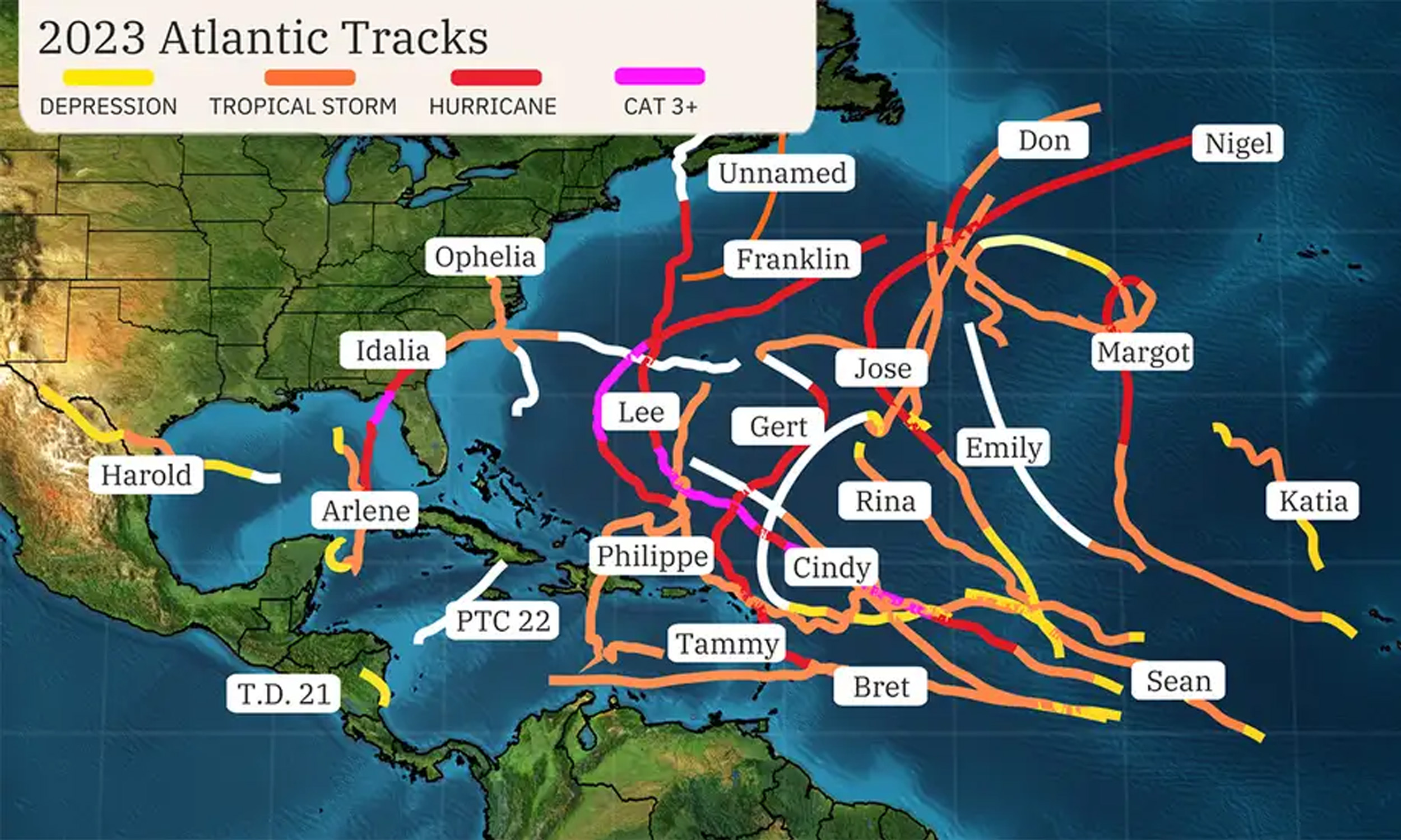
Given these challenges, it's crucial for residents in hurricane-prone areas to understand the limitations of forecasts. While track predictions are becoming more reliable, intensity forecasts are less confident, so preparing for potentially stronger storms is wise. Staying informed with updated seasonal forecasts and having a solid emergency plan, including evacuation routes and supply kits, can make a significant difference. Engaging with local meteorologists and using weather apps for timely updates can also enhance preparedness and response during hurricane season.
Methods and tools used for predictions
Storm forecasting has evolved tremendously with technological advancements, allowing for more accurate predictions than ever before. Meteorologists rely on various tools and methods, such as Doppler radar, weather satellites, and radiosondes, to gather comprehensive data about atmospheric conditions. Doppler radar helps detect precipitation and wind patterns, which are crucial for identifying severe weather events. Satellites like NOAA's GOES-R series continuously monitor the Earth's atmosphere, contributing essential data on cloud formation and sea surface temperatures. Automated Surface Observing Systems (ASOS) constantly record surface conditions, ensuring forecasters have the most up-to-date information.
Integrating this data into numerical weather prediction (NWP) models allows meteorologists to simulate atmospheric processes and predict future weather patterns with remarkable accuracy. These models, such as the Global Forecast System (GFS) and the European Centre for Medium-Range Weather Forecasts (ECMWF), are powered by supercomputers capable of processing vast amounts of information. Recently, hybrid models that combine traditional physics-based approaches with machine learning have further enhanced predictive capabilities, particularly for short-term forecasts and extreme weather events.
Satellite data and computational models provide detailed and continuous observations that feed into these sophisticated models. This synergy allows for precise short-term forecasts, which are generally reliable for 7-10 days. However, long-term predictions remain challenging due to the chaotic nature of the atmosphere, often described by the "butterfly effect," where small initial differences can lead to significant changes over time.
When comparing forecast reliability, NOAA's scientifically grounded methods, which utilize real-time data and advanced technology, offer a high degree of accuracy. In contrast, the Farmer’s Almanac, which relies on a secret formula and historical climatological patterns, provides more anecdotal and less precise predictions.
Factors Influencing Prediction Accuracy
Predicting severe weather involves observing complex atmospheric conditions, oceanic patterns, and climate phenomena like El Niño and La Niña. El Niño, characterized by warmer sea surface temperatures in the central and eastern Pacific, often suppresses Atlantic hurricane activity by increasing vertical wind shear. La Niña, marked by cooler sea surface temperatures, usually enhances hurricane activity by reducing wind shear.
Advancements in technology, such as Doppler radar and satellites, have significantly improved our ability to predict severe weather. Doppler radar provides detailed observations of precipitation, wind patterns, and storm structures, while satellites offer comprehensive data on global weather patterns. NOAA’s supercomputers process vast amounts of data from these sources, running sophisticated numerical models that enhance forecast accuracy. Improved hurricane models like the Hurricane Analysis and Forecast System (HAFS) have provided better predictions of hurricane tracks, intensity, and structure.
Sea surface temperatures play a crucial role in influencing weather patterns. Warmer waters can fuel the intensity of storms and hurricanes, while cooler waters might suppress them. The contrast in temperatures between different ocean regions drives precipitation patterns and can lead to extreme weather events like droughts and heavy rainfall. The Atlantic Multidecadal Oscillation (AMO), currently in a warm phase, correlates with increased hurricane activity in the Atlantic.
As climate change progresses, the frequency and intensity of extreme weather events are expected to rise. NOAA continuously improves observational technologies, modeling techniques, and international collaboration to enhance predictive capabilities. These advancements aim to provide more accurate and reliable severe weather predictions, helping to protect lives and property and mitigate the economic impacts of extreme weather events.
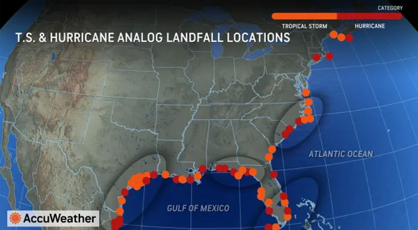
Is your home in a tropical storm or hurricane zone?
If you're concerned about whether your home is in the danger zone during severe weather events, you can utilize several reliable steps and resources. The National Weather Service and the Storm Prediction Center, both part of the NOAA, offer detailed and timely forecasts. Their convective outlooks and weather warnings are updated multiple times a day to provide the latest information on severe weather risks, such as thunderstorms, tornadoes, and hail. These updates are based on extensive meteorological data and analysis, ensuring they are highly credible.
To stay informed, you can visit the SPC's Convective Outlook page, highlighting areas at risk for severe weather. This page provides risk levels ranging from marginal to high, giving you a clear picture of potential threats. The Weather Prediction Center also offers medium-range forecasts and hazard assessments, including excessive rainfall and flash flood risks. They use a blend of deterministic models and ensemble guidance to provide comprehensive and reliable predictions. These resources could help you better understand and prepare for the severe weather risks in your area, ensuring you and your family stay safe.
Knowing local emergency plans and resources is also crucial. Many local governments provide information on designated safe areas and evacuation routes, which can be vital during severe weather events.
Being prepared with a battery backup or whole home generator
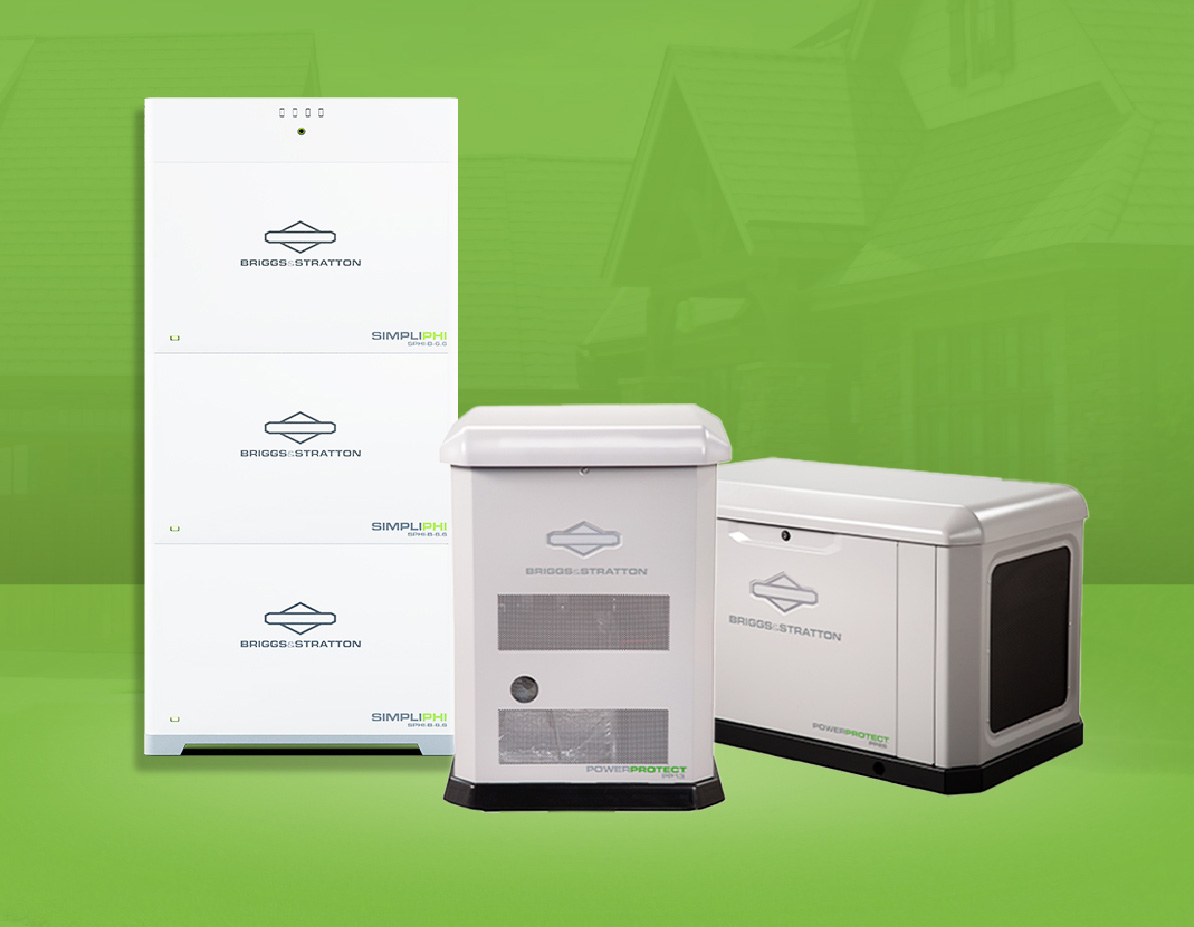
Battery backup systems store energy to power either your whole home or if you choose less battery, essential devices like lights, refrigerators, medical equipment, and communication devices. Batteries can be charged by the grid, a generator or solar panels; these systems are silent and safe. Whole home generators automatically power your entire home, including high-energy appliances like HVAC systems. They run on natural gas or propane, offering flexibility based on your setup.
Prepare for the storm with Briggs & Stratton Energy Solutions lines for Battery stackable home Battery Packages and Standby Generators.

Ready to experience true energy independence?
Request a consultation with a Briggs & Stratton dealer or installer near you by clicking the button below.
Resources
https://hurricanescience.org/science/forecast/models/modelskill/
https://www.noaa.gov/news-release/noaa-predicts-above-normal-2024-atlantic-hurricane-season
https://www.ncei.noaa.gov/access/billions/
https://www.noaa.gov/news/2019-was-2nd-wettest-year-on-record-for-us
https://sitn.hms.harvard.edu/flash/2024/ai_weather_forecasting/


